Snowstorm to pound mid-Atlantic, rage as blizzard in New England
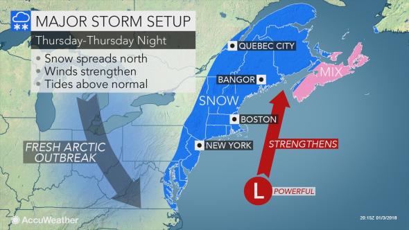
A major storm will track close enough to the Northeast Coast of the United States to bring everything from snow to blizzard conditions and frigid winds into Thursday night.
The storm has undergone rapid strengthening, referred to as bombogenesis. Pressure within the center of the storm crashed 0.95 of an inch of mercury (32 millibars) in nine hours from late Wednesday evening to near daybreak Thursday.
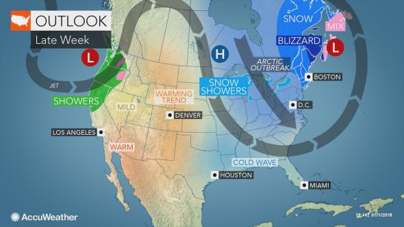
The storm will affect areas from Florida to Maine and Atlantic Canada.
Snow and a wintry mix are set to continue along the southeastern coast of the U.S. through Wednesday night.
Storm impact to be significant in mid-Atlantic, severe in New England
In the Northeast, impact from snow and wind will increase dramatically through Thursday.
Stay up-to-date on the most recent impacts here.
AccuWeather meteorologists believe the heaviest snow and strongest winds from the storm will occur in eastern New England and part of Atlantic Canada